[fusion_builder_container hundred_percent=”yes” overflow=”visible”][fusion_builder_row][fusion_builder_column type=”1_1″ background_position=”left top” background_color=”” border_size=”” border_color=”” border_style=”solid” spacing=”yes” background_image=”” background_repeat=”no-repeat” padding=”” margin_top=”0px” margin_bottom=”0px” class=”” id=”” animation_type=”” animation_speed=”0.3″ animation_direction=”left” hide_on_mobile=”no” center_content=”no” min_height=”none”][fusion_text]
Trip Highlights
- Camping near Capitol Reef
- Driving the Scenic Drive into the Grand Wash and Capitol Gorge
- Taking the Scenic Highway 12 to Bryce Canyon
- Seeing the Sunrise and Sunset View Points in Bryce Canyon
- Hiking to the Emerald Pools in Zion National Park
- Hiking to the Stewart Falls Waterfall near Sundance Ski Resort
[/fusion_text][/fusion_builder_column][fusion_builder_column type=”1_1″ last=”yes” spacing=”yes” center_content=”no” hide_on_mobile=”no” background_color=”” background_image=”” background_repeat=”no-repeat” background_position=”left top” border_position=”all” border_size=”0px” border_color=”” border_style=”” padding=”” margin_top=”” margin_bottom=”” animation_type=”” animation_direction=”” animation_speed=”0.1″ class=”” id=””][fusion_map address=”Salt Lake City, UT|Capitol Reef National Park, Torrey, UT|Bryce Canyon National Park, Bryce, UT|Zion National Park, Washington County, UT|Stewart Falls Trail, Provo, UT” type=”roadmap” map_style=”default” overlay_color=”” infobox=”default” infobox_background_color=”” infobox_text_color=”” infobox_content=”” icon=”” width=”100%” height=”900px” zoom=”7″ scrollwheel=”yes” scale=”yes” zoom_pancontrol=”yes” animation=”yes” popup=”yes” class=”” id=””][/fusion_map][/fusion_builder_column][/fusion_builder_row][/fusion_builder_container][fusion_builder_container background_color=”” background_image=”” background_parallax=”none” enable_mobile=”no” parallax_speed=”0.3″ background_repeat=”no-repeat” background_position=”left top” video_url=”” video_aspect_ratio=”16:9″ video_webm=”” video_mp4=”” video_ogv=”” video_preview_image=”” overlay_color=”” overlay_opacity=”0.5″ video_mute=”yes” video_loop=”yes” fade=”no” border_size=”0px” border_color=”” border_style=”” padding_top=”20″ padding_bottom=”20″ padding_left=”0″ padding_right=”0″ hundred_percent=”no” equal_height_columns=”no” hide_on_mobile=”no” menu_anchor=”” class=”” id=””][fusion_builder_row][fusion_builder_column type=”1_1″ background_position=”left top” background_color=”” border_size=”” border_color=”” border_style=”solid” spacing=”yes” background_image=”” background_repeat=”no-repeat” padding=”” margin_top=”0px” margin_bottom=”0px” class=”” id=”” animation_type=”” animation_speed=”0.3″ animation_direction=”left” hide_on_mobile=”no” center_content=”no” min_height=”none”][fusion_text][fusion_title size=”1″ content_align=”left” style_type=”default” sep_color=”” margin_top=”” margin_bottom=”” class=”” id=””]Day 1[/fusion_title]
From Salt Lake City, drive to Capitol Reef National Park in Torrey, UT (Approximately 3.5 hours)
Sunglow Campground
Once in the area, you have your choice of a few motels or campsites. The campsites within the park tend to fill up early in the day. We chose to camp at the Sunglow Campground, about 10 minutes outside of the park. We made reservations, but the campground has about 10 first-come, first serve sites. When we arrived, we were the only ones there, but after sunset, the campground was full.
[fusion_title size=”3″ content_align=”left” style_type=”default” sep_color=”” margin_top=”” margin_bottom=”” class=”” id=””]Day Hikes[/fusion_title]
Once your sleeping situation is decided, head out to enjoy the park! We did the hike to the Hickman Bridge. It’s only about 2 miles round-trip, the hike is easy enough for youngsters or people that are not used to hiking. The elevation gain is approximately 400 ft, and it offers canyon views and a 133-foot natural bridge at the turning point of the hike.
Hickman Natural Bridge
The NPS offers a trail guide with many other options which you can choose from based on your skill level and interests:
Trail One-Way Distance Elevation Change in Feet Difficulty Description Capitol Gorge 1.0 mi
(1.6 km)80 ft
(24 m)Easy Deep canyon, historic inscriptions, short climb to waterpockets (“tanks”) Goosenecks 0.1 mi
(0.2 km)(EasyDramatic canyon views Grand Wash 2.2 mi
(3.6 km)200 ft
(61 m)Easy Deep canyon, narrows Sunset Point 0.4 mi
(0.6 km)(EasyPanorama, good for sunset Cohab Canyon 1.7 mi
(2.7 km)440 ft
(134 m)Moderate Hidden canyons, views of Fruita, panoramas at spur trail view points Fremont River 1.0 mi
(1.7 km)480 ft
(146 m)Moderate Easy stroll along river, then steep climb to panoramas Hickman Bridge 0.9 mi
(1.4 km)400 ft
(122 m)Moderate 133-foot natural bridge, canyon views Cassidy Arch 1.7 mi
(2.8 km)670 ft
(204 m)Strenuous Natural arch, slickrock, canyon views Chimney Rock Loop
round trip3.6 mi
(5.9 km)590 ft
(180 m)Strenuous Panoramas of Waterpocket Fold cliffs, good for sunset Fremont Gorge Overlook 2.3 mi
(3.6 km)1,090 ft
(332 m)Strenuous Short climb to open mesa top, ends at high viewpoint on rim of gorge Frying Pan 2.9 mi
(4.6 km)810 ft
(247 m)Strenuous Connects Cohab Canyon and Cassidy Arch trails, ridgetop panoramas Golden Throne 2.0 mi
(3.2 km)730 ft
(223 m)Strenuous Views of Capitol Gorge and Golden Throne Navajo Knobs 4.7 mi
(7.6 km)1,620 ft
(494 m)Strenuous Continuation of Rim Overlook Trail, 360-degree mountaintop panorama Old Wagon Trail Loop round trip 3.8 mi
(6.1 km)1,080 ft
(329 m)Strenuous Pinyon-juniper forest, views of cliffs and Henry Mountains Rim Overlook 2.3 mi
(3.6 km)1,110 ft
(338 m)Strenuous Panoramas of Fruita and Waterpocket Fold from atop dramatic cliff

Capitol Reef – Fremont River
[fusion_title size=”3″ content_align=”left” style_type=”default” sep_color=”” margin_top=”” margin_bottom=”” class=”” id=””]Scenic Drive[/fusion_title]
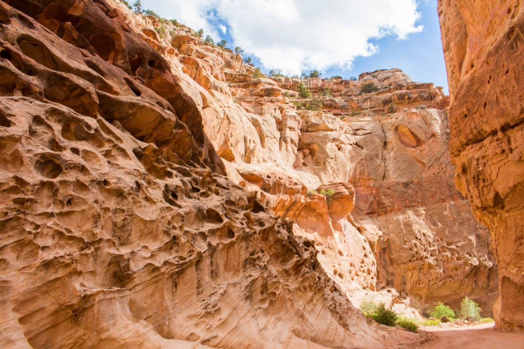
Solution Pockets
We also drove the Scenic Drive in Capitol Reef. The NPS even has a guide to follow on the drive if you’re curious about the ecology or geography. There is a $10 entrance fee (honor system) to access the scenic drive. The layers in the rock tell the history of the area.
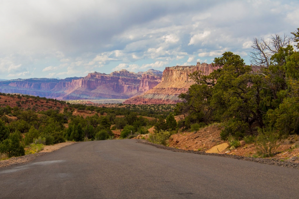
Layers of Time on Colorado Plateau
According to the NPS, the tilting rocks are caused by the following:
“Intense crustal pressure reactivated a fault buried deep beneath the sedimentary rock layers of the Colorado Plateau. In response, the overlying sedimentary rock layers folded or bent into a one-sided slope called a monocline. This 100 mile (161 km) long (but relatively narrow) feature was uplifted approximately 6,800 feet (2,000 m) higher on the west side. It is named the Waterpocket Fold because of the numerous small potholes, tanks, or “pockets” that hold rainwater and snowmelt.”
After a visit to the park, you can return to your campsite or hotel, eat some dinner, and relax in the red rock haven.

Grand Wash on Scenic Drive
[fusion_title size=”1″ content_align=”left” style_type=”default” sep_color=”” margin_top=”” margin_bottom=”” class=”” id=””]Day 2[/fusion_title]
Campsite Views
Try out breakfast in the town of Torrey, UT before heading down south! There are some cute cafes in the area, and once you’re on the road to Bryce (Approximately 2.5 hours away), there won’t be many options.
[fusion_title size=”3″ content_align=”left” style_type=”default” sep_color=”” margin_top=”” margin_bottom=”” class=”” id=””]Highway 12 Scenic Byway[/fusion_title]
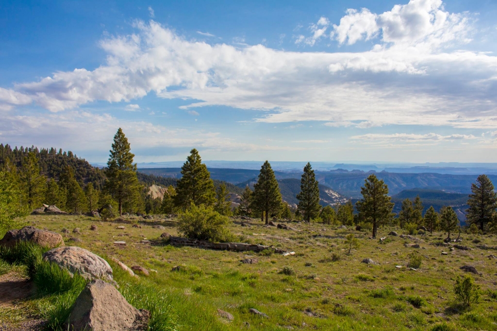
Scenic Route 12
Utah is awesome in the fact that it was such a diverse landscape and scenery. One of the best ways to see the terrain is on one of the state’s scenic drives. Even though it’s not the fastest road at an average speed of 40 mph, it provides such an interesting drive that you won’t regret this choice. Scenic Byway 12 features 124 miles of rugged terrain. There is an interactive map that you may explore more of the features and activities offered on the highway. I’d like to spend a little more time down there exploring, but for the purposes of this trip we just enjoyed the views as we continued to our next destination, Bryce Canyon.
[fusion_title size=”3″ content_align=”left” style_type=”default” sep_color=”” margin_top=”” margin_bottom=”” class=”” id=””]Bryce Canyon National Park[/fusion_title]
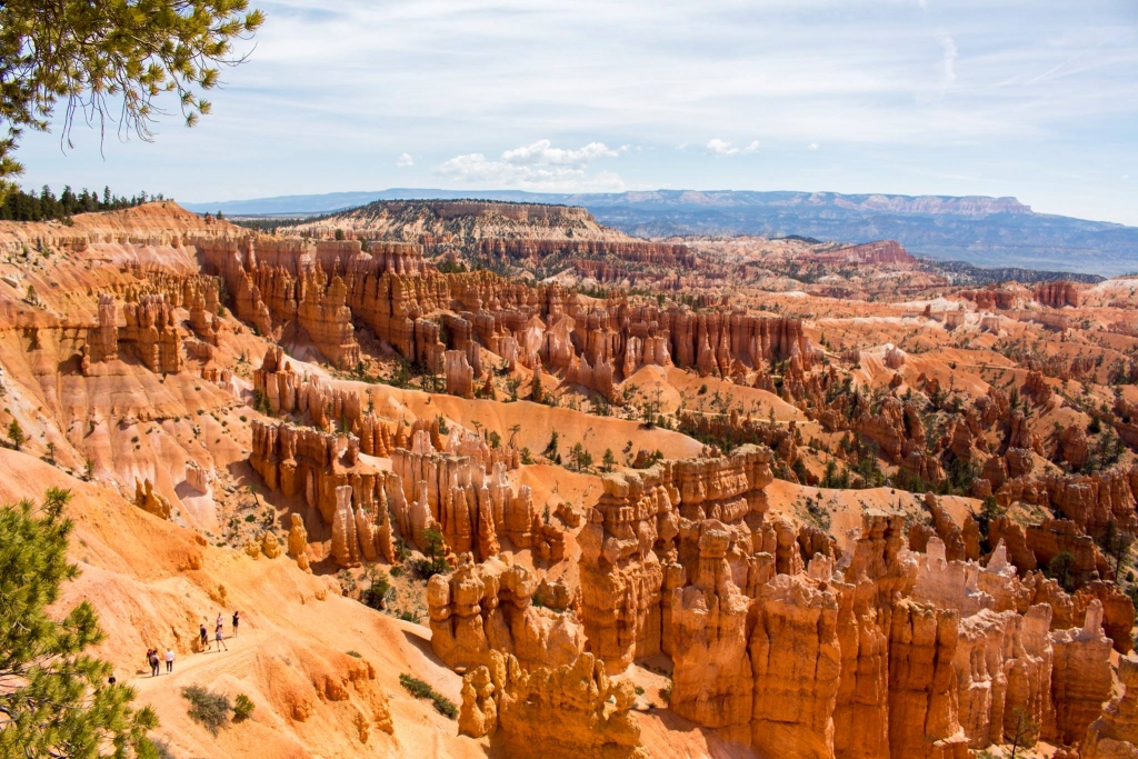
Bryce Canyon View Point
Bryce Canyon is located in the town of Bryce. This park features viewpoints which visitors can stop and take pictures. It’s great for visitors who like to visit the park, but are limited on time and do not have time to hike the trails. If you do have time, I’d suggest stopping at the Visitor Center to check out your options based on the time you do have. For our trip, we stopped at the Sunrise and Sunset points along the Rim Trail.
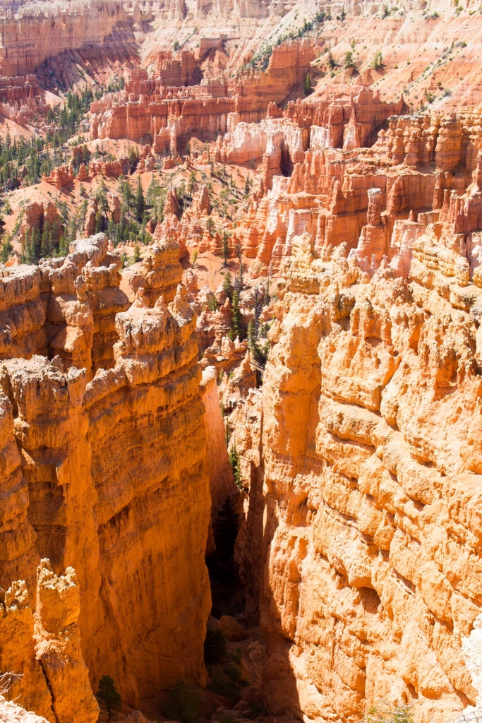
The Hoodoos
Bryce Canyon has the unique feature of Hoodoos. Hoodoos are described as “odd-shaped pillars of rock left standing from the forces of erosion.” While there are hoodoos in other continents, Bryce is still one one of the most unique places on our earth to feature this geology. I dare you go to see for yourself. I can guarantee you’ll be in awe.
We didn’t intend on making this stop on our trip originally, but we were glad we did! Don’t miss it if you’re passing through the area.
Brighton and I at Bryce Canyon
[fusion_title size=”3″ content_align=”left” style_type=”default” sep_color=”” margin_top=”” margin_bottom=”” class=”” id=””] Zion National Park[/fusion_title]
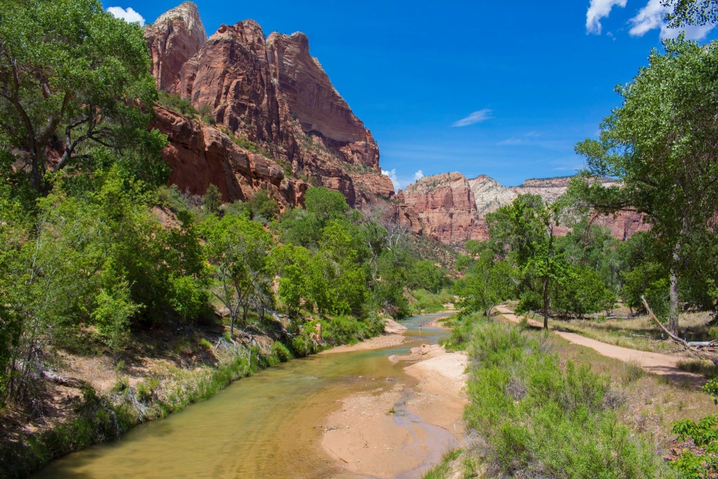
Just a short drive away (approximately 1.5 hours) is my favorite national park in Utah. Zion is just magical. I tell all my visitors that they should go there. It’s an awesome mix of winding rivers, lush green underbrush, and towering red rock canyons. The main road that you can enter via either the west or east side of the park is State Route 9 or Zion Park Blvd. Depending on your available time, I’d recommend visiting the Visitor’s Center to pick up a copy of the map and the Hiking Guide.
Zion National Park
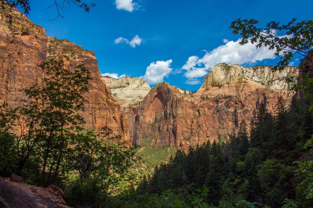
For our trip, we decided to do the Emerald Pools hike. It’s a couple miles out and back to the three pools. The hike to the first two is relatively easy, and the hike to the last pool is moderate with more elevation gain than the others. It’s definitely a good option for out of state, low elevation dwellers and families.
View of Zion Canyon along Emerald Pools Hike
After the hike we went to a local restaurant, Cafe Oscar which has a delicious, affordable variety of food with huge portions. I like this place because it’s got such a great artsy vibe that really demonstrates the laid back and creative vibe that Zion National Park fosters. With full bellies and tired bodies, we drove back to Salt Lake City (approximately 4.5 hours from the park).
[fusion_title size=”1″ content_align=”left” style_type=”default” sep_color=”” margin_top=”” margin_bottom=”” class=”” id=””]Day 3[/fusion_title]
Stewart Falls near Sundance Ski Resort
Even though we had such an adventurous couple days, we wanted our visitor to really see Utah’s diversity of landscape. We took him up a short day hike within an hour’s drive of Salt Lake.
[fusion_title size=”3″ content_align=”left” style_type=”default” sep_color=”” margin_top=”” margin_bottom=”” class=”” id=””] Stewart Falls Hike – Provo, Utah[/fusion_title]
To get to the Stewart Falls trailhead, you can navigate to Aspen Grove Trailhead/Campsite along the Scenic Alpine Loop. This trail is located in Provo Canyon near Sundance Ski Resort. There will be a fee to enter the recreation area, currently it’s $6 or included in the American The Beautiful Annual Pass.
Trail to Stewart Falls
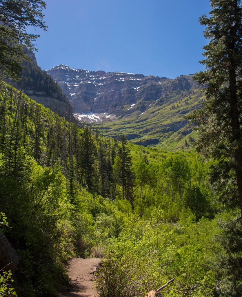
This scenic waterfall hike is about 4 miles round trip. It takes you wandering through alpine scenery with some elevation gain right from the beginning. The trail is partly shaded, so bring some sun protection.
View of Mt.Timpanogos from Stewart Falls Hike
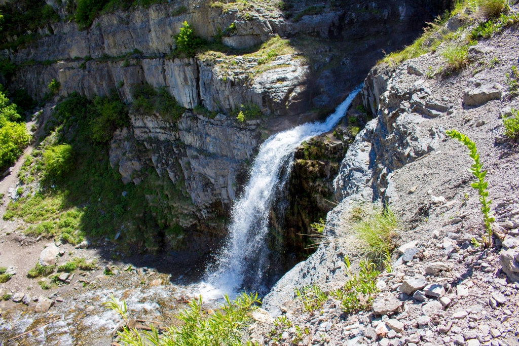
We made the mistake of not bringing enough water for three adults, but it was still a beautiful day. At the end of the hike, you’re rewarded with a majestic waterfall that cascades from two places above– It’s over 200 feet tall! While I’ve only done this hike in summer months, I’d imagine it’s beautiful during spring, summer, and fall since Aspen Grove area is known for having beautiful leaves during the fall as well.
View of Stewart Falls from Above
[fusion_title size=”1″ content_align=”left” style_type=”default” sep_color=”” margin_top=”” margin_bottom=”” class=”” id=””]Summary[/fusion_title]
Miles Driven: 820 miles
Hours of Driving: 14 hours total
Level of Difficulty: Easy-Moderate with hikes
Number of National Parks Visited: 3 National Parks and 1 National Forest
Minimum Days Needed: 3 days, but could be extended to 4 for leisure
[/fusion_text][/fusion_builder_column][/fusion_builder_row][/fusion_builder_container]


