[fusion_builder_container hundred_percent=”yes” overflow=”visible”][fusion_builder_row][fusion_builder_column type=”1_1″ background_position=”left top” background_color=”” border_size=”” border_color=”” border_style=”solid” spacing=”yes” background_image=”” background_repeat=”no-repeat” padding=”” margin_top=”0px” margin_bottom=”0px” class=”” id=”” animation_type=”” animation_speed=”0.3″ animation_direction=”left” hide_on_mobile=”no” center_content=”no” min_height=”none”][fusion_title size=”3″ content_align=”left” style_type=”default” sep_color=”” margin_top=”” margin_bottom=”” class=”” id=””] Mt. Timpanogos via Timpooneke Trailhead[/fusion_title][fusion_text]
Mount Timpanogos has been on my bucket list ever since I got into hiking in the Wasatch Range. It’s a popular Utah hike for the locals here. Its elevation is 11,752 ft. It is the second highest mountain in Utah’s Wasatch Range after Mt. Nebo.
According to the good ol’ Wikipedia, “the name comes from the Timpanogots tribe who lived in the surrounding valleys from AD 1400. The name translates as “rock” (tumpi-), and “water mouth” or “canyon” (panogos).”
Story time! When I first moved to Utah, Brighton told me about a folklore legend related to this mountain. According to the NPS website, this is a condensed version told on the Cave Tours.
Long, long ago, there were Indians that lived on Timpanogos. Every year they gave a sacrifice to the great god Timpanogos. One year it was very dry, and the Indians thought the great god was angry with them.
The Chief had a young daughter who was very beautiful and of age to be chosen as the sacrifice. All the young girls in the tribe were blindfolded and given an opportunity to choose a pebble from a pottery dish. The chief’s daughter, Utahna, chose the black pebble. It was her fate to go atop the mountain and be the sacrifice.
All of her tribesmen were sad and they wanted someone else to go instead. But, she bade her friends goodbye and ascended the mountain, winding her way towards the highest peak.
When she reached the top, she knelt in prayer. Begging for rain, with her arms outstretched, she made her plea to the God of Timpanogos. A handsome young brave had watched her and followed her to the top. “Please do not jump!” Red Eagle said. Utahna thought Red Eagle was the Great God of Timpanogos. He led her to a cave and there they lived for many years. As time went by the two fell in love.
One day Red Eagle was attacked and injured by a bear. Because he was hurt, Utahna knew he was not the Great God of Timpanogos. She cared for him until he got well, then she left one morning to ascend the mountain and complete her sacrifice.
When the sun was up, she stretched out her arms and leaped to the crags below. Realizing too late where she had gone, the young warrior found and gathered her broken body in his arms and carried her to the cave. In the cave their two hearts were made into one, as we see in the Great Heart of Timpanogos.
If you look closely at the mountain, people say you can see an outline of Utahna lying on the top of Mount Timpanogos.
[/fusion_text][/fusion_builder_column][fusion_builder_column type=”1_1″ background_position=”left top” background_color=”” border_size=”” border_color=”” border_style=”solid” spacing=”yes” background_image=”” background_repeat=”no-repeat” padding=”” margin_top=”0px” margin_bottom=”0px” class=”” id=”” animation_type=”” animation_speed=”0.3″ animation_direction=”left” hide_on_mobile=”no” center_content=”no” min_height=”none”][fusion_title size=”3″ content_align=”left” style_type=”default” sep_color=”” margin_top=”” margin_bottom=”” class=”” id=””]The Specs[/fusion_title][fusion_text]*Disclaimer: We did not do the summit on this trip, these specs are for our trip only
The Specs:
Total Distance: 13-14 miles (RT)
Total Elevation Gain: About 3500 ft
Dog Friendly: Yes
Trailhead Bathrooms: Yes (and one along the trail with a view!)
Difficulty: Difficult

[/fusion_text][/fusion_builder_column][fusion_builder_column type=”1_1″ background_position=”left top” background_color=”” border_size=”” border_color=”” border_style=”solid” spacing=”yes” background_image=”” background_repeat=”no-repeat” padding=”” margin_top=”0px” margin_bottom=”0px” class=”” id=”” animation_type=”” animation_speed=”0.3″ animation_direction=”left” hide_on_mobile=”no” center_content=”no” min_height=”none”][fusion_title size=”3″ content_align=”left” style_type=”default” sep_color=”” margin_top=”” margin_bottom=”” class=”” id=””]Getting There[/fusion_title][fusion_text]Getting There:
From I-15 take the 284 exit and turn left onto UT-92 East. Go 8 miles until you enter the American Fork Canyon and you’ll approach a fee booth.
The current fees for Alpine Loop are as follows:
- 1-3 Day — $6.00
- 7-Day — $12.00
- Annual — $45.00
- They also accept Interagency Passes which is what we currently have.
Continue on another 8.2 miles until you come to the Timpooneke Campground on the right side of the road. Turn right into the campground area, and the trailhead is just past the campsites.[/fusion_text][/fusion_builder_column][fusion_builder_column type=”1_1″ background_position=”left top” background_color=”” border_size=”” border_color=”” border_style=”solid” spacing=”yes” background_image=”” background_repeat=”no-repeat” padding=”” margin_top=”0px” margin_bottom=”0px” class=”” id=”” animation_type=”” animation_speed=”0.3″ animation_direction=”left” hide_on_mobile=”no” center_content=”no” min_height=”none”][fusion_title size=”3″ content_align=”left” style_type=”default” sep_color=”” margin_top=”” margin_bottom=”” class=”” id=””]The Trail[/fusion_title][fusion_text]
(Source)
Trail Highlights:
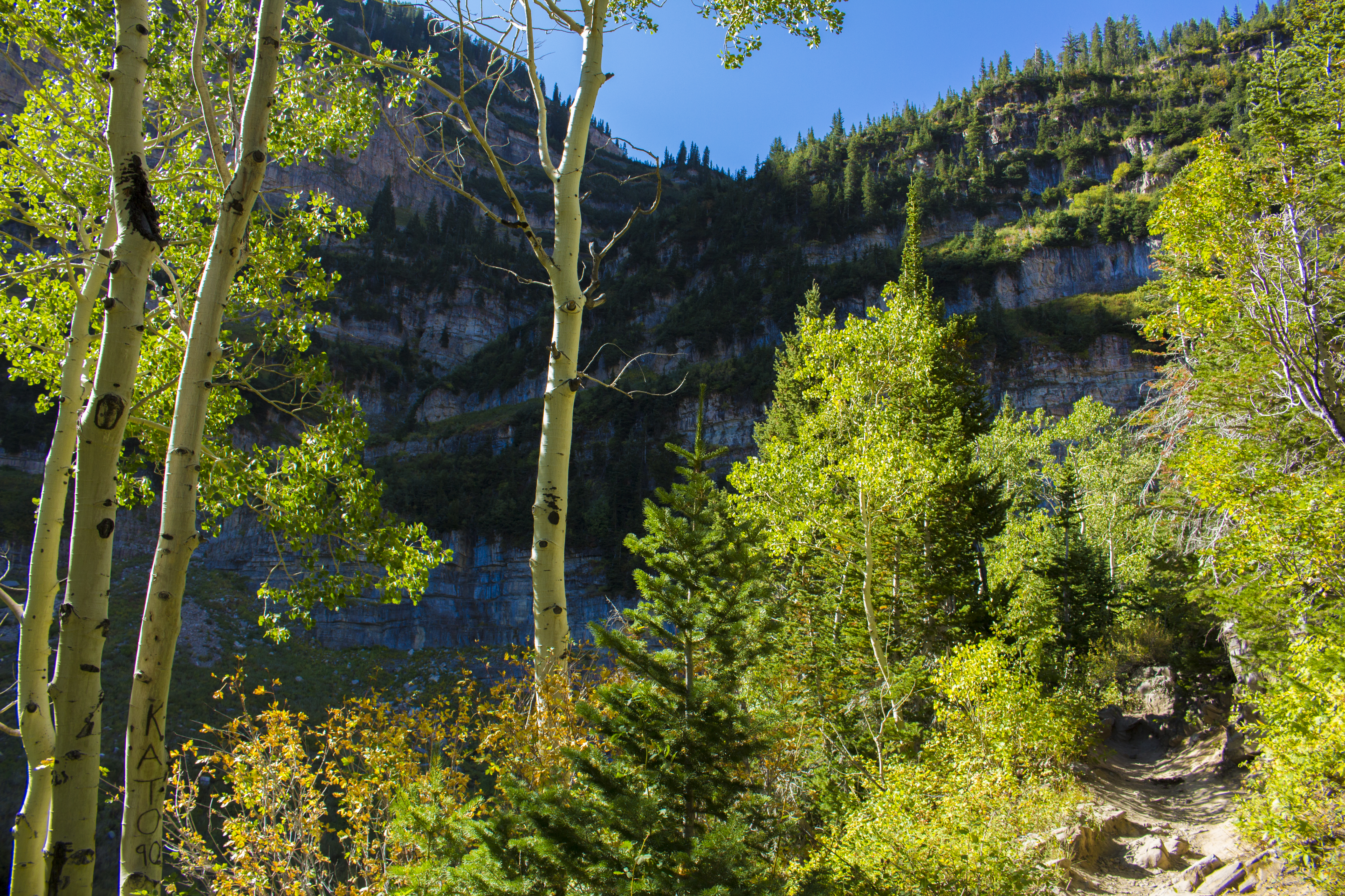
- The trail starts out in a heavily forested area with not very much access to views of the valley. After the trail wanders through a couple aspen groves and some damp parts of the trail, you’ll see a sign for Scout Falls which is at about 1.5 miles into the trek. We decided to skip it this time, due to our time constraints. The path is obvious as it continues up some minor switchbacks.

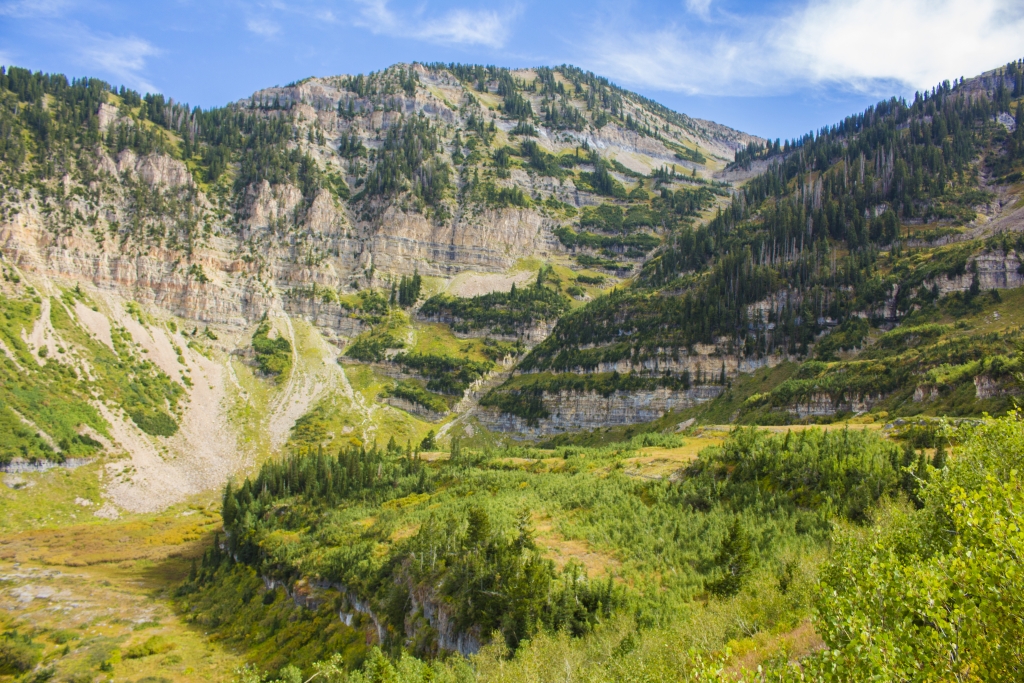
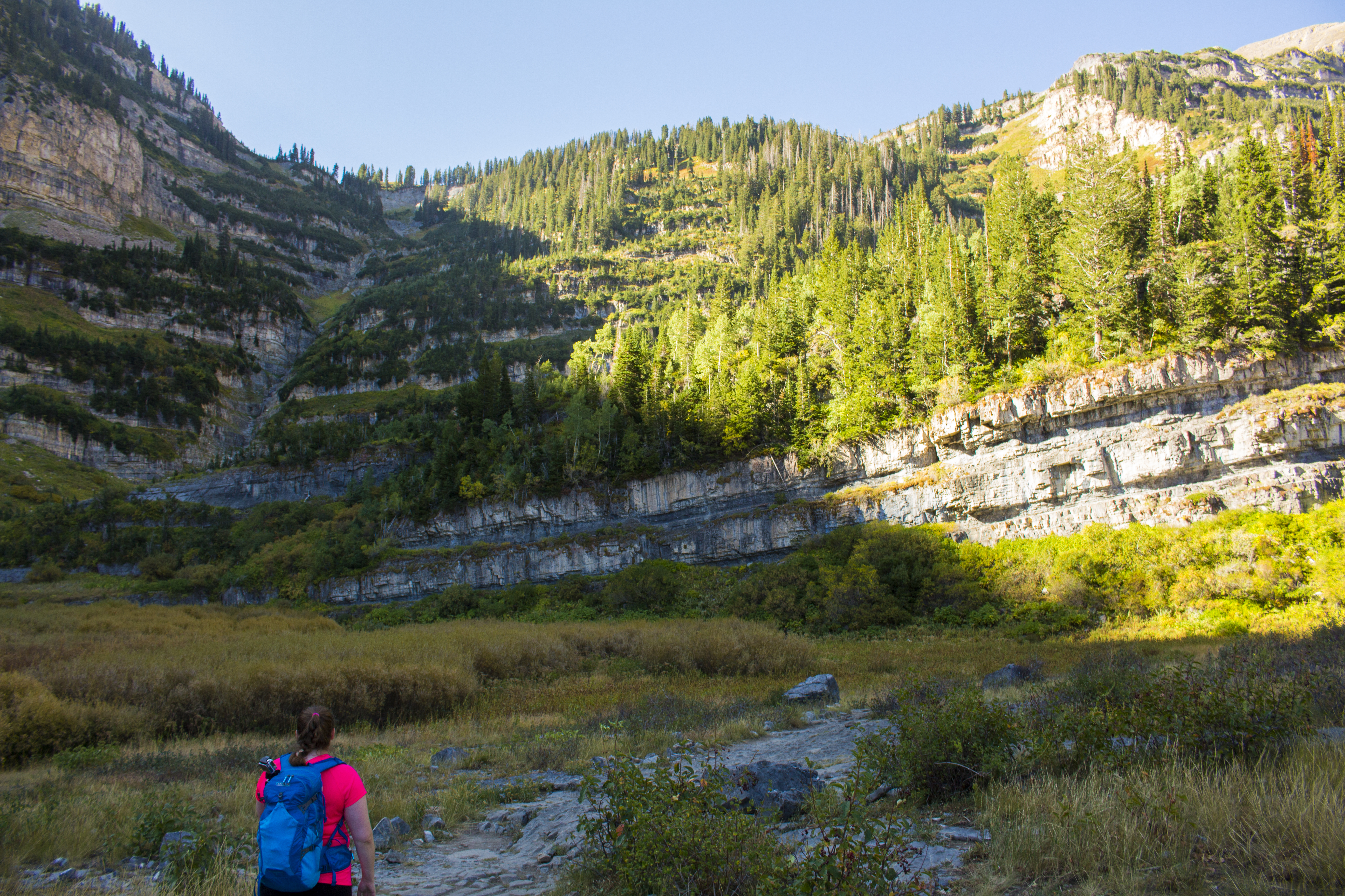
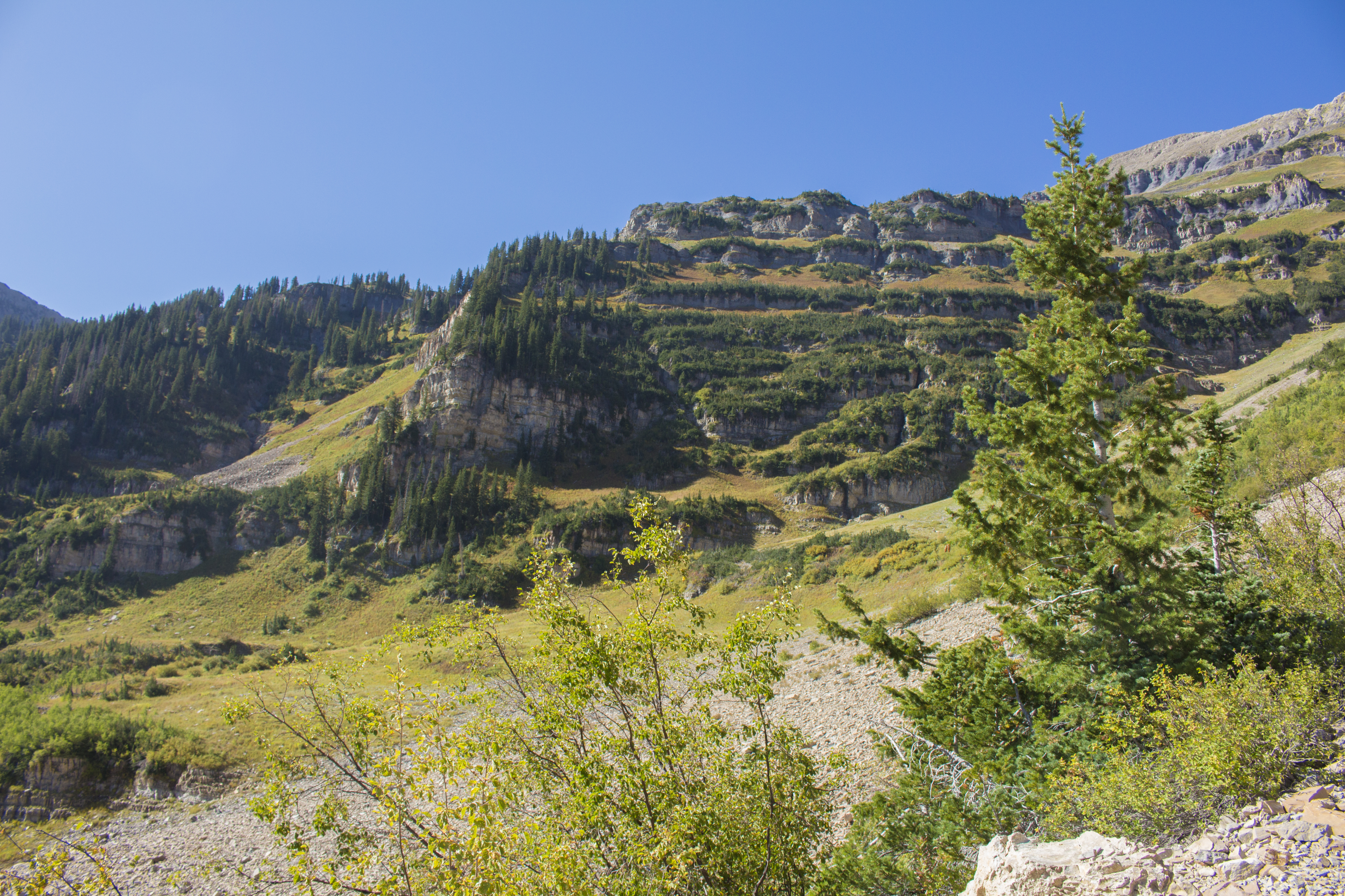
- The next portion of the hike you will approach is the Lower Basin. It’s quite pretty, even with the seasons beginning to change for fall. This portion is pretty flat and we saw some great camping sites there. In wildflower season, I bet this area is just gorgeous and popping with color. As the trail wanders through some high grass, it begins up into the Giant Staircase.
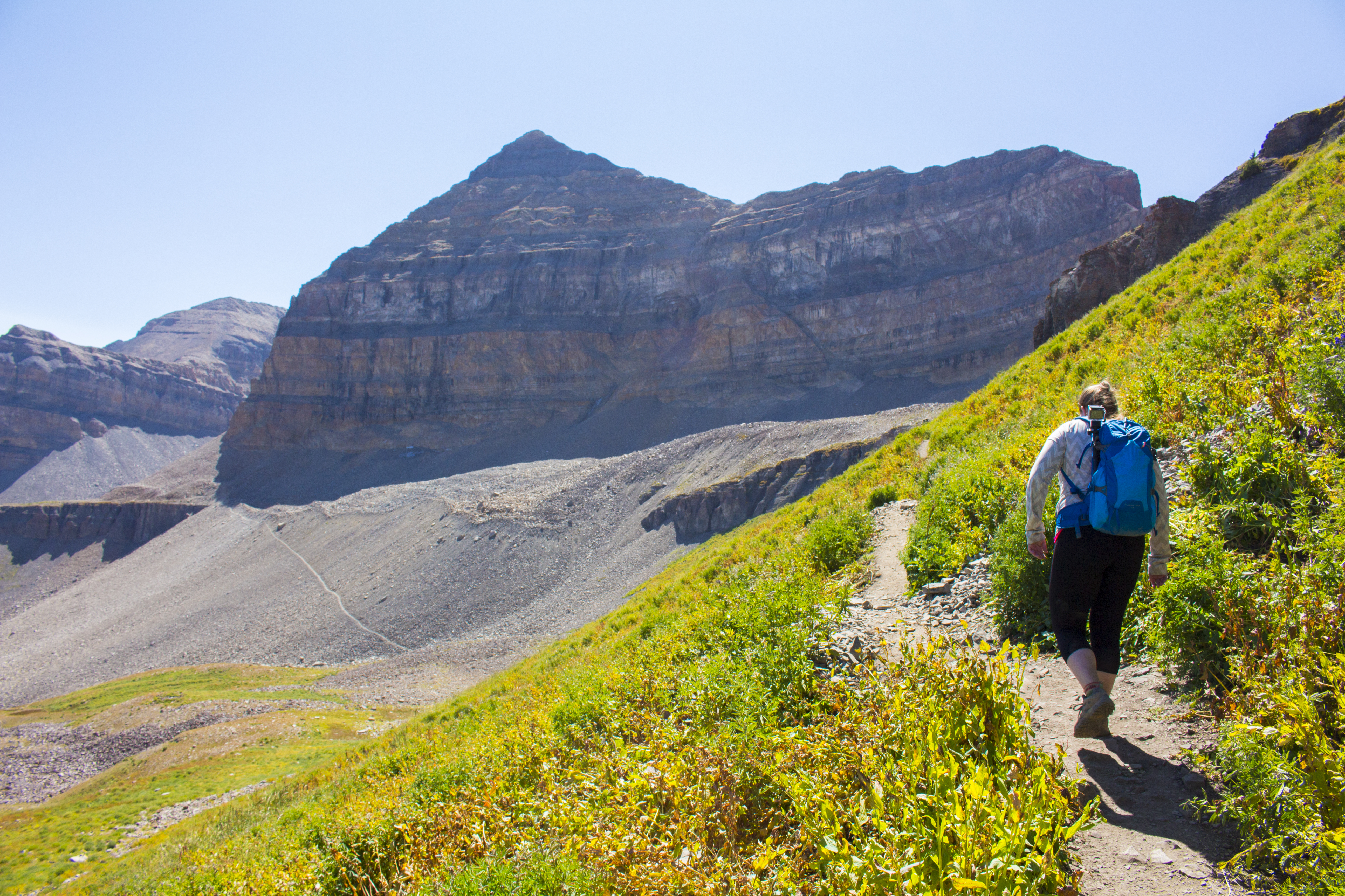
- The Giant Staircase is the next portion of this trail that you will understand as soon as you are there. There are lots of switchbacks that gain a bit of elevation. There are some great views of the Wasatch range as you’re climbing through this. Some portions of this bit are through small boulder fields and rocky, so watch your step through these.
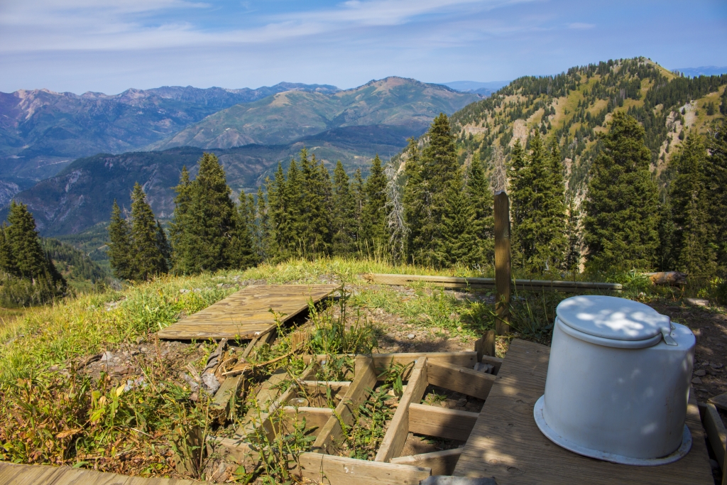
- Just as I felt like the staircase was going nowhere, the Timpanogos Basin opened up in front of us. During this portion, there are a couple junctions. The first is a sign that says “Toilet” and literally is just that. It is not in the best shape, but it does have a great view. I could not resist a picture!
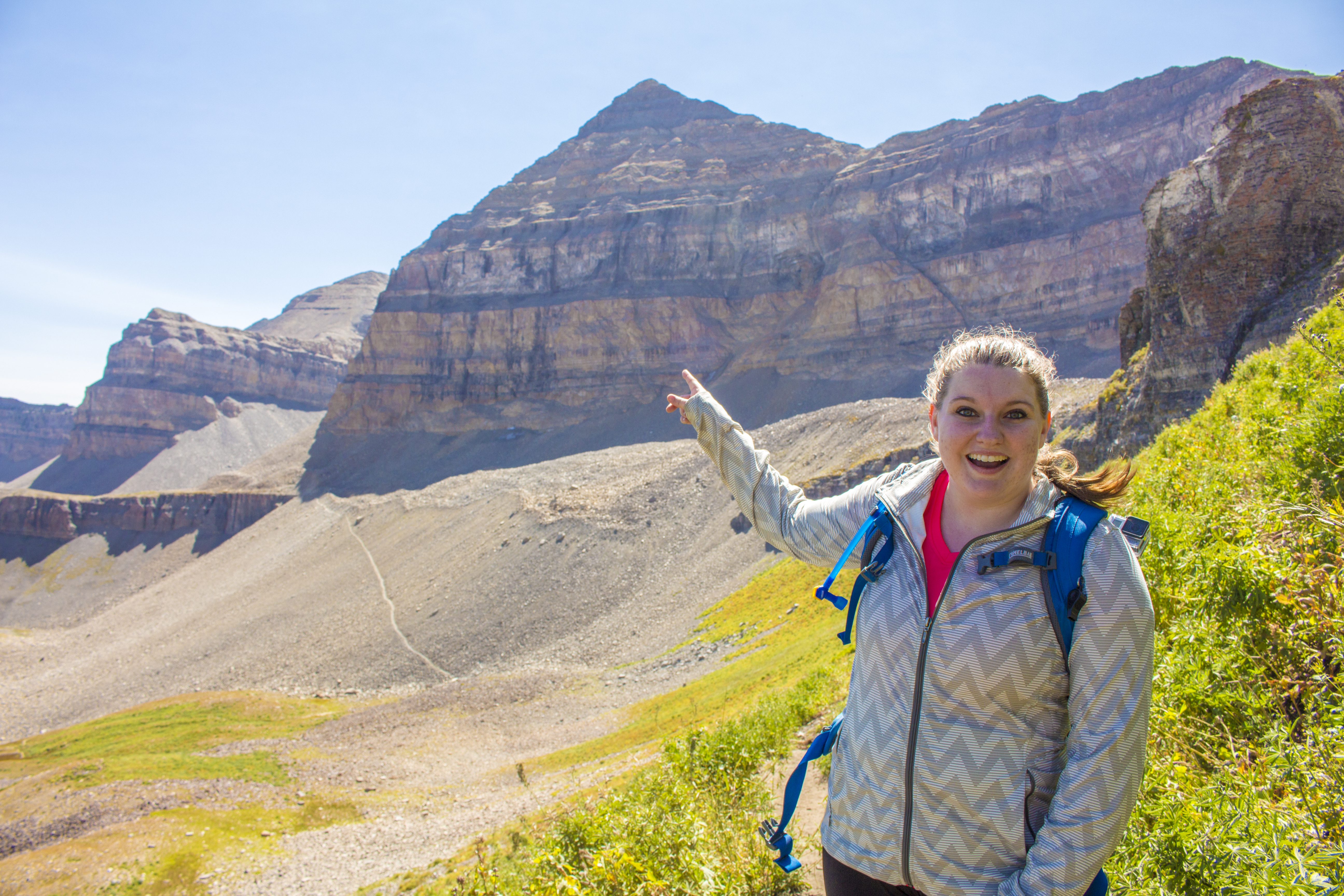
- The second is a sign indicating the summit trail and the trail to Emerald Lake. We talked with a fellow hiker who had been to both and suggested that the Saddle is a “worthy goal” for those who were unsure about completing the summit. While the weather was cool, we had plenty of water, I was just not feeling 100% for that summit, despite that being the ultimate goal of this hike. We took a break, enjoyed the views, and ate a snack as we discussed our options.


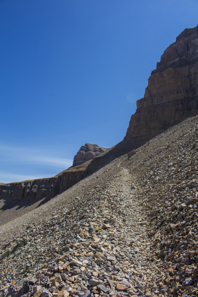
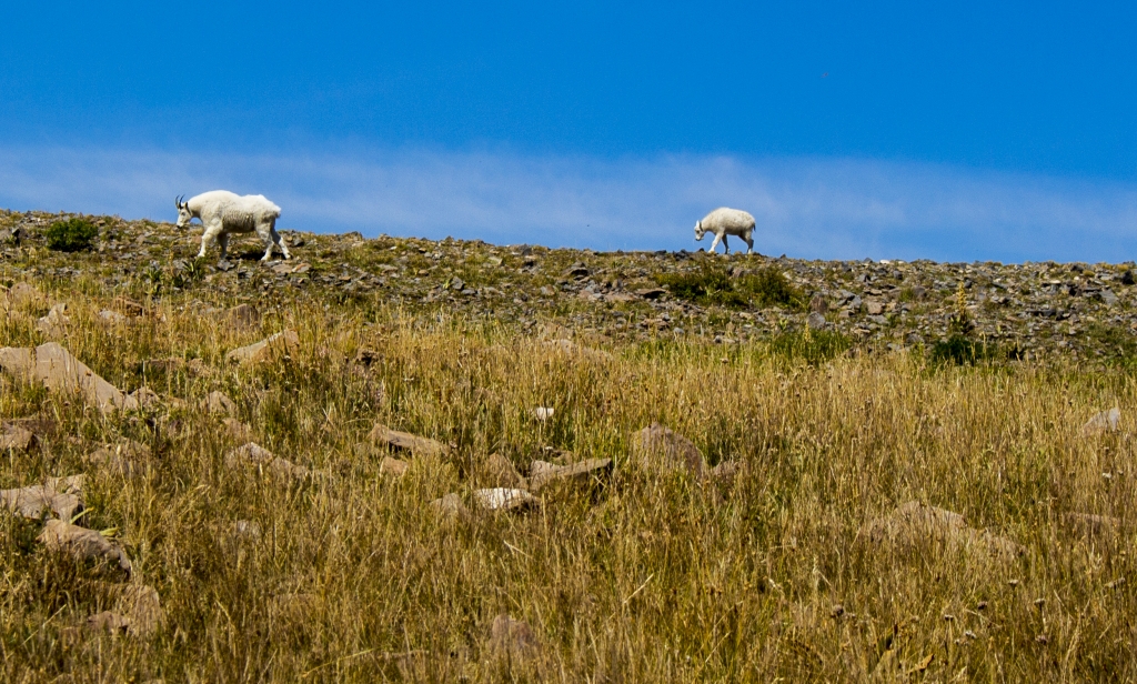
- We followed the trail towards the Saddle and Summit, but we decided that we’d save this for another day. I did get to see a few mountain goats hanging out along the mountainside. We thought it was best to heed the advice that our bodies were giving. Brighton felt his hip becoming aggravated and I was not at my best for some reason that I didn’t know (Two days later, I am sick with a head cold. That must’ve been why!).

- Instead, we turned around, followed the path back down and cut through to the trail for Emerald Lake.
- The trail for Emerald Lake that we had seen earlier looked attainable, so we gave it a shot instead of coming all this way just to turn around! It was a rocky path that I didn’t really enjoy.
- Brighton felt like it was a little too narrow for his comfort levels, but we continued up it carefully and slowly. Safety first! As we got to the top of this divide in the terrain, we could see where it continued down into the Emerald Lake area and a shack. We saw a couple more mountain goats, which I was excited about. I named our friends Harold and Edmund. Haha!
- The lake was very small and shimmery. To be frank, I was unimpressed. I would say that it’s just due to our timing. A couple hikers we passed said that it was unusually low. At this point, we decided to turn back towards the car.
[/fusion_text][/fusion_builder_column][fusion_builder_column type=”1_1″ background_position=”left top” background_color=”” border_size=”” border_color=”” border_style=”solid” spacing=”yes” background_image=”” background_repeat=”no-repeat” padding=”” margin_top=”0px” margin_bottom=”0px” class=”” id=”” animation_type=”” animation_speed=”0.3″ animation_direction=”left” hide_on_mobile=”no” center_content=”no” min_height=”none”][fusion_title size=”3″ content_align=”left” style_type=”default” sep_color=”” margin_top=”” margin_bottom=”” class=”” id=””]Summary[/fusion_title][fusion_text]
I can definitely why this trail would be a local favorite among the Utahns. I believe that we were too late in the season to really appreciate the beauty of this area, as all of the wildflowers were dead and the leaves were already beginning to change in some places. The positive to this was that the trail was not nearly as crowded as I’d expected it to be, and we were easily able to find parking at the trailhead at 8:45am.
I’d like to attempt this summit again next summer or when fall is in full swing, but make it a backpacking trip. There were some great campsites around, and the break in between hiking would probably make this trip a little easier on the feet and joints.
Have you ever climbed to the summit of Timp? Any advice for overcoming the thin air at high elevations?
[/fusion_text][/fusion_builder_column][/fusion_builder_row][/fusion_builder_container]