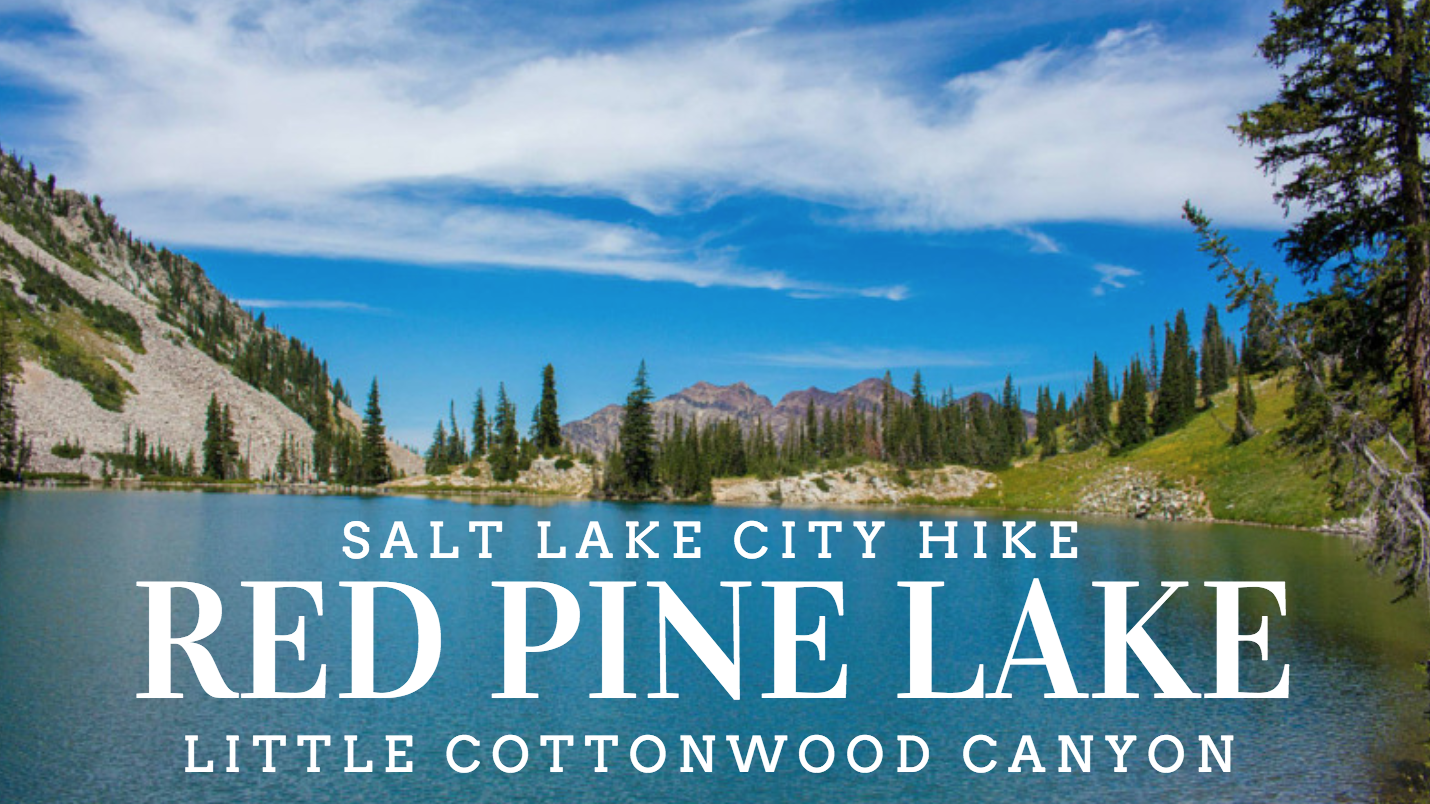
When I pick hikes, I typically look for alpine lakes, epic views for days, and a peak to bag. Red Pine Lake checked all of those boxes. While I didn’t bag Pfeifferhorn in the Wasatch front, it’s back on my bucket list, saved for another day. I was treated to some amazing views from the ridge line and a lake that is a deep blue that makes this one of my favorite hikes in the area!
 Trail Stats
To Lower Red Pine Lake-
Total Distance: 10 miles
Total Gain: 2000 ft
To Ridge Line-
Total Distance: 12 miles
Elevation Gain: 3000 ft
Dog Friendly: No, it’s watershed area
Trailhead Bathrooms: Yes
Difficulty: Strenuous
Fees: None
Trail Overview
I have a confession to make. I have barely explored Little Cottonwood Canyon since being in Salt Lake City. I’m not sure why, it’s a beautiful canyon right in my backyard. We were supposed to be going up to Pfeifferhorn via Red Pine Lake Trailhead, but unfortunately we did not make it there. Nevertheless, it was an amazing hike.
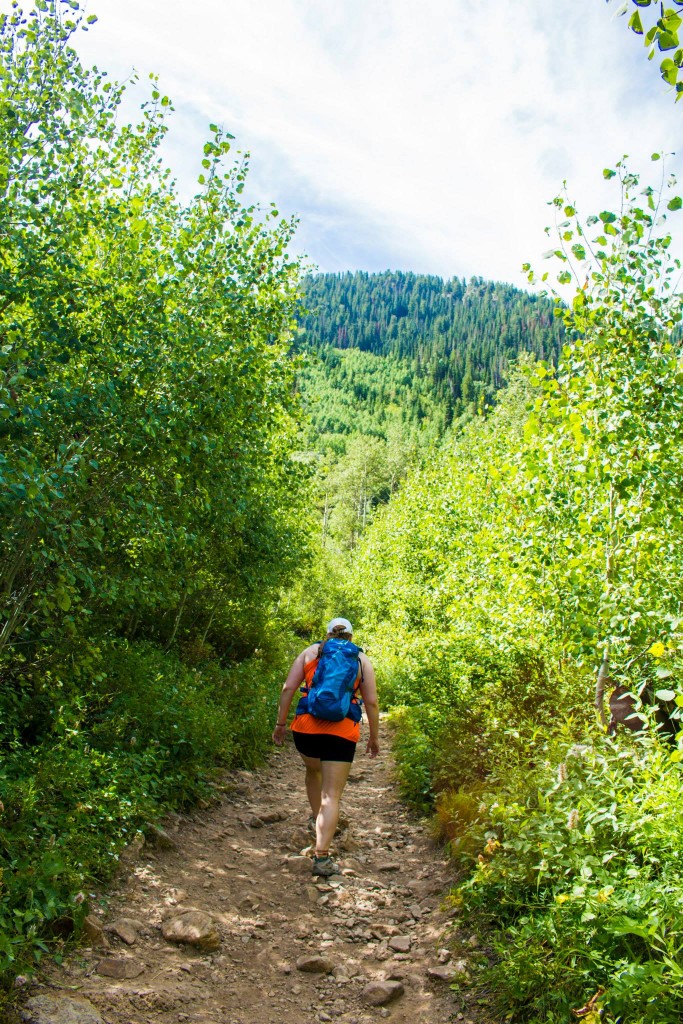
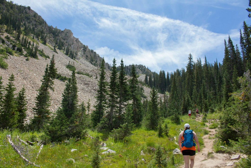
We started around 10:45am on a hot summer day. I had about 2L of water, and Brighton had about 2.5L of water to start with. We’ve been using Nuun electrolyte tablets in our water, and it’s been extremely helpful on these hot days. The hike starts out at the White Pine Lake/Red Pine Lake Trailhead. At first, the trail takes you along a relatively flat rocky trail until it splits off into the two trails. We followed the split off directly behind the Red Pine Lake sign, and you cross a few man-made bridges over the streams.
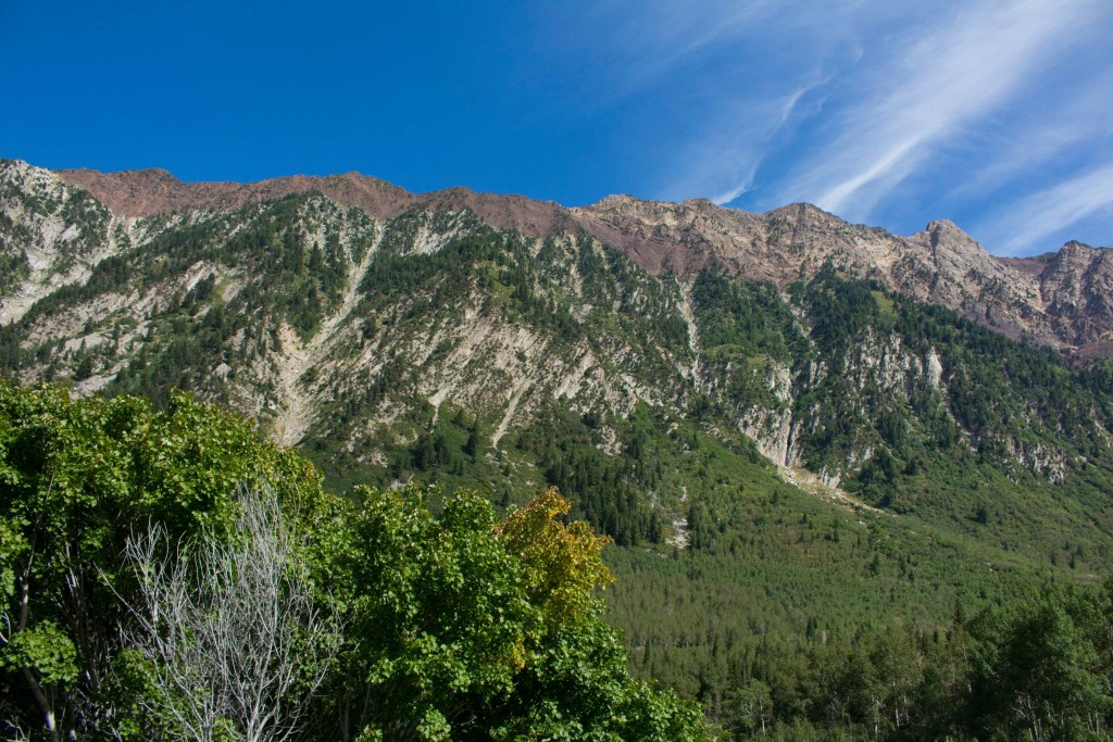
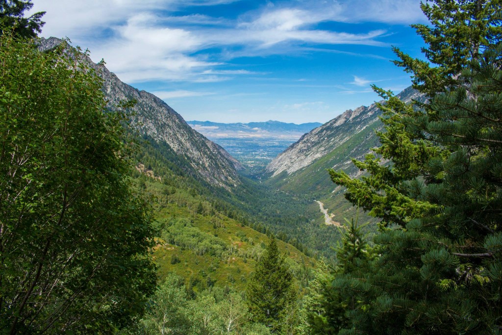
The trail begins to get ever-so-slightly steeper and wanders through a couple aspen groves. This part was one of my favorites because as you get higher, it opens up into a view down Little Cottonwood Canyon.
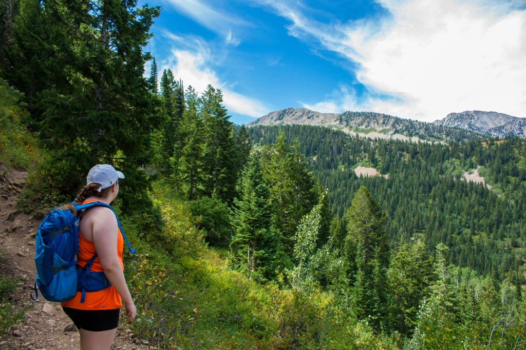
The trail continues up with a gradual elevation gain. There are a couple slightly steeper portions, but the trail is manageable as it winds its way through the forest. Brighton and I took our time with lots of mini breaks. An issue that I’ve had with these longer hikes is the weight of the water, especially with the elevation gain. I want to try to drink all the water in the beginning to reduce the weight, but it backfires later on in the hike. I’d like to look into a water filter since many places on this hike had water opportunities, but we couldn’t drink any of it without a filter.
The trail goes into this narrow section that feels humid and swampy. This is where it begins to get noticeably steeper.
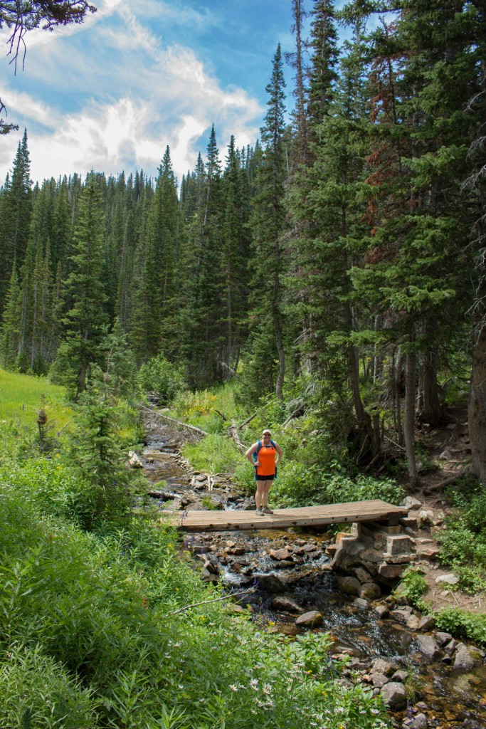
The terrain was varied, which is another reason I really enjoyed this hike. It wasn’t too much of any one type of scenery. We approached this bridge which had a sign on the righthand side saying that trail continued up. I took a break for a photo op on this bridge.
We saw many hikers this afternoon because it was a Saturday in July.
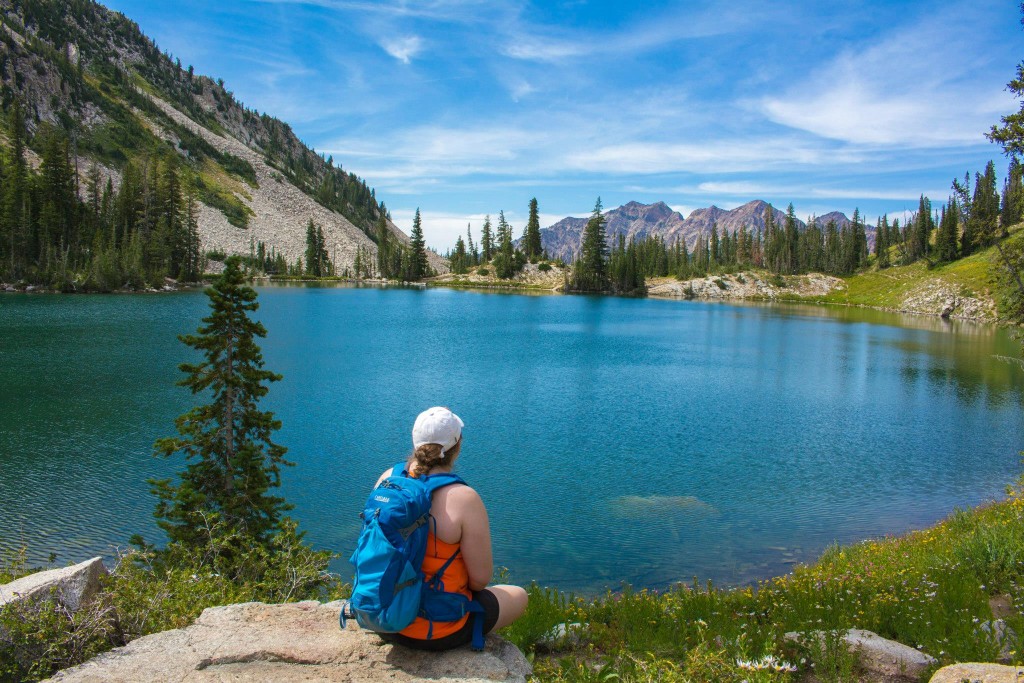
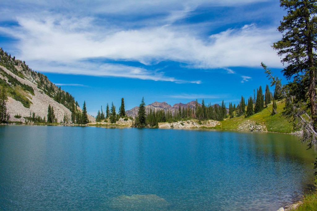
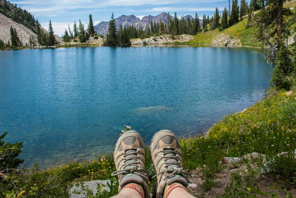
After this portion, the trail got pretty steep and rocky. We had to take a few longer breaks to catch our breath. We talked to a few hikers who had come from Pfeifferhorn, who said that we had a long longer to go. I guess they weren’t kidding. I was under the impression that it was 5 miles to the peak, but it was actually about 4(ish) miles to the lower Red Pine Lake. We kept trekking and were rewarded with the view of this incredibly blue lake. Such a beautiful deep blue!
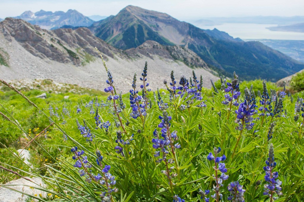
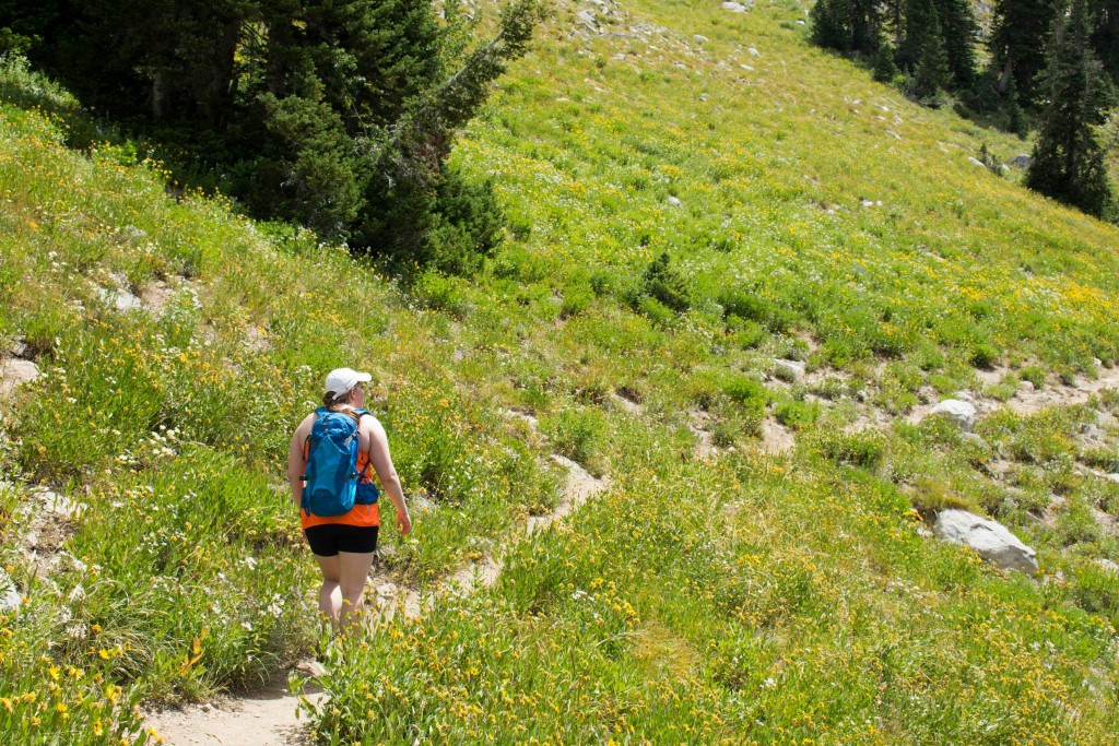
 Next to the lake, on the left side the trail continues into this field of wildflowers. It’s really quite beautiful.
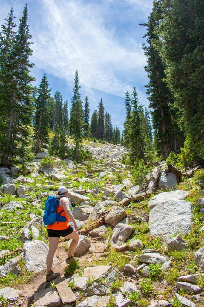
We saw many people enjoying picnics here. I’d imagine that camping here would be a great experience. In fact, we saw many backpackers coming down with their gear in the morning and on our way back many going up to the lake. We were a little unsure of where the trail continued up to Pfeifferhorn but we asked friendly hikers along the way, and they steered us in right direction. The trail goes into the alpine forest briefly, and then there a field of boulders which we temporarily went off trail during. We saw some hikers on the opposite side and they told us that the trail was on that side. My guess is that you can’t really go wrong in this portion because it’s ultimately leading the same place. I wasn’t about to add extra mileage onto this daunting hike though. We crossed the boulders and eventually made it up to the upper Red Pine Lake. It was non-existent. Sad day for us due to the extremely dry summer and lack of snow, I’d assume.
This portion of the hike was pretty steep and we took lots of breaks to keep going.
It got to the point where we were briefly boulder hopping, and Brighton decided to put the camera away shortly after that.
We continued up and up along the trail, anticipating to reach the peak soon. The trail was pretty daunting for the two of us. Brighton does not like heights or cliffs, and even I was a little nervous on the part right before the ridge line. There was a lot of loose rock and sand, and we used our hands to help us get to the top. Other hikers had poles, but we didn’t bring any. I think that as beginner hikers, it was harder than we had anticipated. Scrambling takes practice from what I understand. There was a brief moment that we considered turning around right then, but we decided to make it at least to the ridge line if we weren’t going all the way to the peak.
I’m glad we made it. Just look at this view!
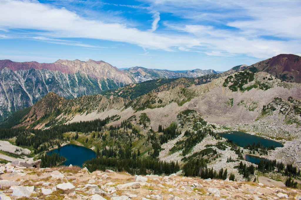
This is looking down into Little Cottonwood Canyon.
On the opposite side, you can see Timpanogos and Utah Valley. Pretty wildflowers!
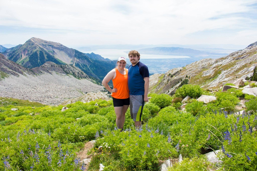
Even at the ridge line, you can see for miles!
We stopped, took our pictures and decided that it was best for us to turn around and head back. My Fitbit said that we had traveled about 6 miles up to where we were, and we were essentially out of water at this point with 6 miles to go. I had researched this trail prior to leaving the house and it said that the worst scrambling was still yet to come. Based on the lack of water, lack of experience, our endurance level, and our time constraints, we headed back down. Pfeifferhorn will happen another day.
A Word of Caution
I learned after the hike that there is some class 3 scrambling just after where we made it to. I think that we did the portion of class 2 to get to the ridge line. I didn’t understand what this meant and found out about the Yosemite Decimal System. According to Wikipedia, these are the classes:
Class 1: Walking with a low chance of injury, hiking boots a good idea.
Class 2: Simple scrambling, with the possibility of occasional use of the hands. Little potential danger is encountered. Hiking Boots highly recommended.
Class 3: Scrambling with increased exposure. Handholds are necessary. A rope should be available for learning climbers, and if you just choose to use one that day, but is usually not required. Falls could easily be fatal.
Class 4: Simple climbing, with exposure. A rope is often used. Natural protection can be easily found. Falls may well be fatal.
Class 5: Is considered technical roped free (without hanging on the rope, pulling on, or stepping on anchors) climbing; belaying, and other protection hardware is used for safety. Un-roped falls can result in severe injury or death.
Class 5.0 to 5.15c is used to define progressively more difficult free moves.
Class 6: Is considered Aid (often broken into A.0 to A.5) climbing. Equipment (Etriers, aiders, or stirrups are often used to stand in, and the equipment is used for hand holds) is used for more than just safety.
I am not an experienced rock climber. This is scary to me. Perhaps now is the time to go practice at Momentum Indoor Climbing?
We tried to go down as quickly and safely as we could since we were tired and our feet hurt. This was the longest we had ever hiked and the highest elevation gain we had tackled. Overall, a challenging hike and worth the effort. If we were to do this again, I’d have trekking poles, bring a more water, a water filter, and perhaps an experienced friend to help me with the scrambling part. I know many people get a thrill out of the scrambling, but I know my comfort level and how much I’m willing to venture out of it.
Getting There
Take I-215 S and exit on 6200 South towards Big/Little Cottonwood. Turn left after exiting the interstate. Continue East to the canyon on Utah 210, following signs for Snowbird and Alta. Drive 4.6 miles up Little Cottonwood Canyon and park at the White Pine Trailhead parking lot, or along the gravel at the side of the road if it’s too busy.
Comments
0 responses to “Red Pine Lake [Hike]”
I also loved this hike! I did it in the fall and the leaves were outstanding! We made it to the lake and then past it to the second lake higher up. My favorite part was the view of the lake from above (as you captured beautifully!). I did not love crossing that HUGE boulder field. Great post great information!
Love this summer view!
Katie @ Katie Wanders
http://www.katiewanders.com